
Explore Our Projects
Discover some of the tools we've developed. All applications listed here are publicly available and have links to their product websites and additional information.
Featured Projects
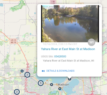
HIVIS
The Hydrologic Imagery Visualization and Information System (HIVIS) provides access to tens of millions of image products and time-lapse videos from the National Imagery Management System (NIMS), integrated into interactive maps alongside other hydrologic data. This unique web application delivers valuable information about site conditions, both past and present, aiding scientists, policymakers, and the public in making informed decisions about our water resources.
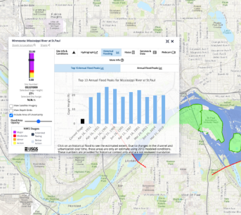
Flood Event Viewer
The USGS Flood Event Viewer (FEV) provides public access to event-based coastal and riverine water level and high-water mark records corresponding to major storms and other short-term events. This application allows users to view and download data.
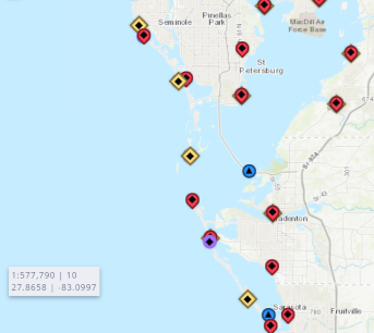
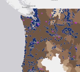
Real-Time Flood Impact Map
The USGS Real-Time Flood Impact (RTFI) Map displays locations of critical infrastructure—such as roads, bridges, buildings, and embankments—alongside real-time streamgage data. When water levels at nearby monitoring stations exceed surveyed heights of these vulnerable features, the map highlights them to indicate potential or active flooding, providing early warning and helping communities protect lives and property.
StreamStats
StreamStats provides access to spatial analytical tools providing USGS water science-backed information that are useful for water-resources planning and management, and for engineering and design purposes.
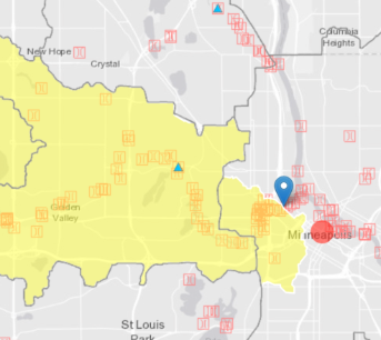
Flood Inundation Mapper
The USGS Flood Inundation Mapper combines flood inundation map libraries with real-time USGS river-level data and National Weather Service flood forecasts into a powerful tool that helps communicate when and where flooding may occur and better inform local responses that can protect lives and property.
SPARROW
SPARROW is a collection of tools for relating water-quality monitoring data and watershed attributes. SPARROW models are designed to describe the spatial patterns of water quality and the factors that affect it. WIM has partnered with SPARROW scientists to provide a suite of map applications depicting SPARROW models for different regions of the U.S. and parts of Canada.
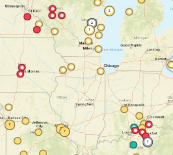
WHISPers
WHISPers is the Wildlife Health Information Sharing Partnership event reporting system. It is a web application exposing wildlife mortality data submitted by partners across North America and verified by trained biologists.
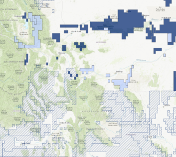
National Wetlands Inventory
The U.S. Fish and Wildlife Service is the principal federal agency that provides information to the public on the extent and status of the nation's wetlands. The agency has developed a series of topical maps to show wetlands and deepwater habitats which can be viewed and downloaded through the wetlands mapper.