Bad River Groundwater Model
The Bad River Groundwater Model Mapper is a companion product to the U.S. Geological Survey (USGS) Scientific Investigations Report 2015-5162 "Groundwater-Surface Water Interactions in the Bad River Watershed, Wisconsin," available at: this URL. The mapper displays information for a regional groundwater-flow model documented in the SIR report. Model results and supporting data are displayed in an interactive geographic context, allowing the user to zoom in to inspect the data in greater detail, in relation to local geographic features. The mapper also allows for presentation of more comprehensive suite of results than that featured in the report.
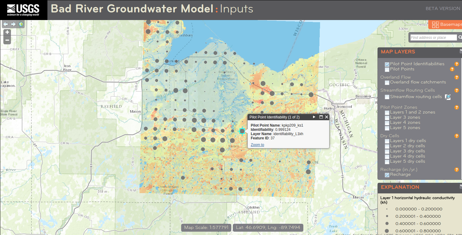
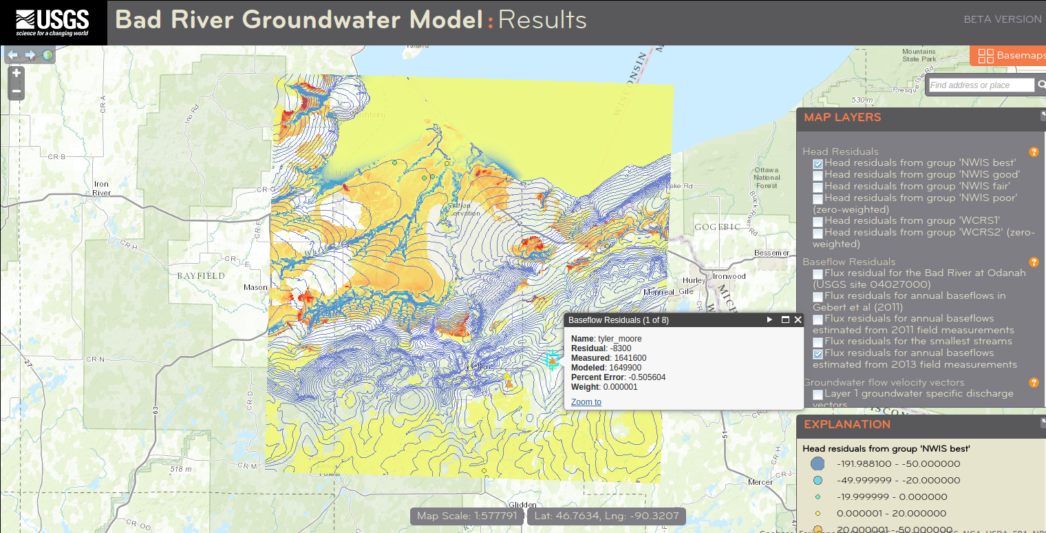
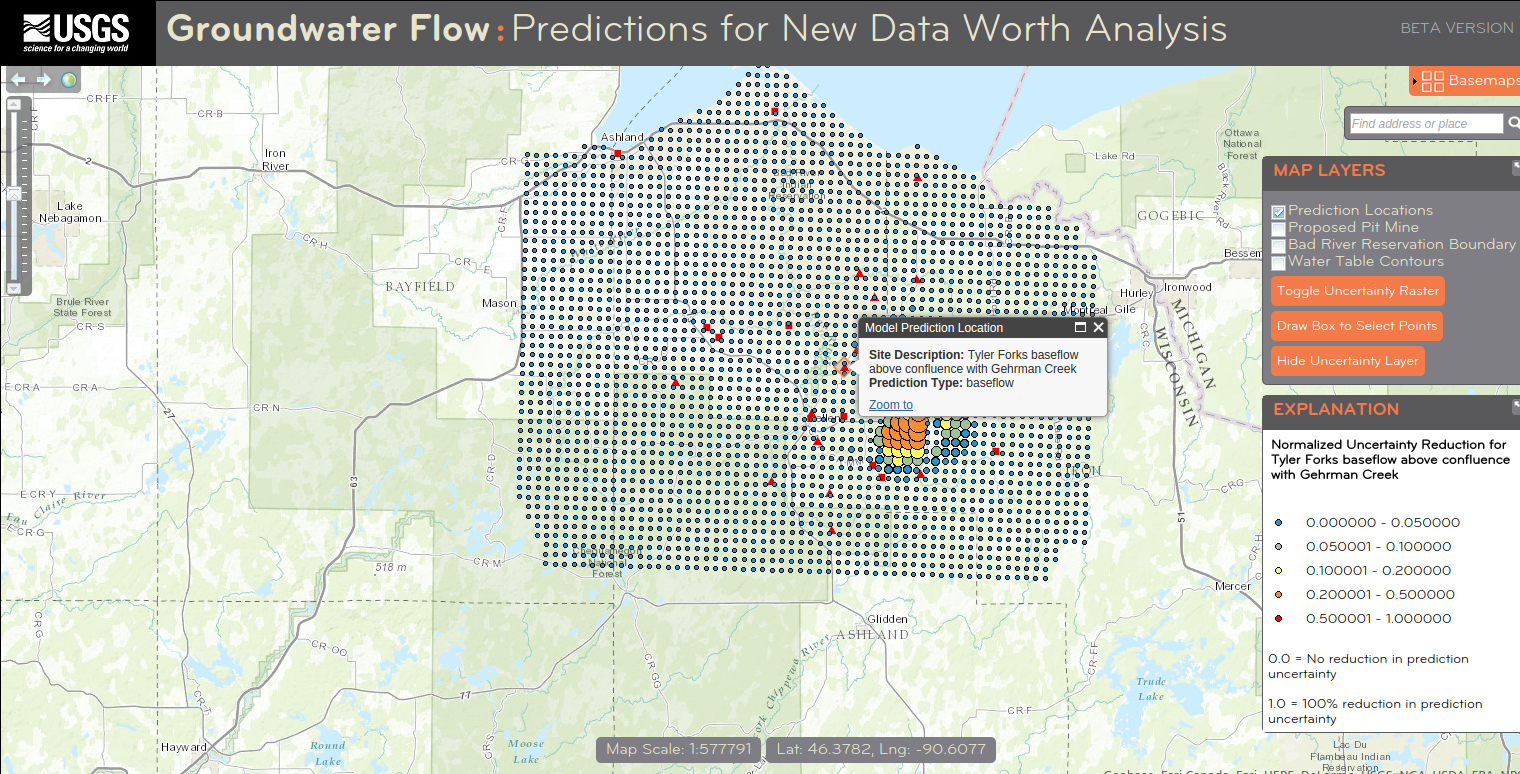
The mapper is divided into three map applications. The "Inputs Mapper" displays inputs to the model such as estimates of aquifer recharge and hydraulic conductivity. The "Results Mapper" displays model outputs including simulated water-table elevations, groundwater-flow directions, baseflows in streams, and comparisons of model outputs to field measurements. The third application, the "New Data Worth Mapper" displays the results of an analysis evaluating potential monitoring well locations for their ability to increase confidence in 29 model predictions. New Data Worth results are presented as reductions in uncertainty for a suite of model predictions, with values of 1 indicating locations where the addition of a monitoring point would result in a 100% (complete) reduction in model uncertainty for that prediction, and 0 values indicating locations that provide no information to the model about that prediction.

![]() U.S. Department of the Interior
|
U.S. Geological Survey
U.S. Department of the Interior
|
U.S. Geological Survey
URL: https://www.wim.usgs.gov/badriver
Page Contact Information:
Webmaster
Page Last Modified: Thursday, 12-November-2015 8:36:15 EDT